Geo Data Coordinates
Advertisement


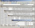
Geodaten International Houses (deutsch) v.1.00
For many countries house coordinates are present with coverage degrees upto 100 percent. The geo data offered here are in high-precision quality and are present in different coordinate and reference systems.
Advertisement
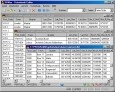
Geodaten German Streets (deutsch) v.1.00
For the area of the Federal Republic of Germany more than 2,7 million street coordinates with a coverage of 100% are available. The geo data offered here are in high-precision quality and are present in different coordinate and reference systems.
CONVERT (Deutsch) v.1 3
The freeware program CONVERT converts any dBase formatted data base tables and special the Geo Data supplied by KilletSoft GbR as dBase tables into different data formats.

CONVERT (English) v.1 3
The freeware program CONVERT converts any dBase formatted data base tables and special the Geo Data supplied by KilletSoft GbR as dBase tables into different data formats.

GPSInfo v.1.6.0.0
Display and share all your GPS data: *Coordinates (Latitude and Longitude) *Speed, course (heading) and GPS Compass (only while moving) *Altitude, GPS date and time *Horizontal and vertical accuracy *GPS mode (Full GPS or A-GPS) Additional
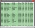
Geodata Germany v.22.03
The database contain geodata of the Federal Republic of Germany with geo referenced towns, municipalities, town quarters, administrative units, postal codes, telephone preselections, nature areas, landscapes, climatic zones for proximity searches ec.
GridImp
Imports gridded data into MS-MapPoint, to produce attractive data maps. Can handle imperfect data, holes, re-gridding, etc. Can be used to import such attributes as pollution data, seismic hazard, geological information, customer/population
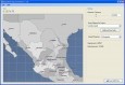
AnyChart Flash Map Converter v.1.0.4
Convert ESRI ShapeFiles (.SHP) geolocation data into AnyMap format to be used with AnyChart. AnyChart Flash Map Converter allows making use of a wide choice of maps with AnyChart, a GIS system that recognizes map data in AnyMap format only.
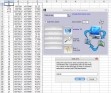
XLPoints Plus v.1 3
XLPoints Plus is the easiest way to massively draw points in AutoCAD and generate 3D models using coordinate data in Excel. Key Features: - Quickly draw points using coordinate data in Excel. - Create new drawings or update existing ones by
ASF SAR Training Processor v.1. 1. 2010
The SAR Training Processor (STP) is a graphical tool written to assist in learning and teaching the flow of SAR processing. After installation, you will have a start-menu shortcut that you can use to run the SAR Training Processor.
QPlot v.1.2.4286.0
QPlot: Allow you view or digitize scatter data. Visualize scatter data starting from your NotePad; Support line point series and tabular column field data (read more for supported data format); Import export data through copy and paste; Online data